Shorts and slops or an umbrella? Here’s what the weather holds for every province in South Africa on Monday, 31 July 2023.
Severe weather alerts
IMPACT-BASED WARNINGS
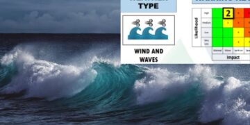
A. Orange level 5 warning: Winds and waves resulting in disruptions to ports/harbours and possible coastal infra-structure damage is expected between Plettenberg Bay and Port Edward.
B. A Yellow level 2 WARNING: Winds and waves resulting in disruptions to beachfront activities and difficulty in navigation at sea are expected between Cape Columbine and Plettenberg Bay.
C. Yellow level 2 Warning: Damaging winds resulting in problems for high-sided vehicles on prone routes and localised damage to settlements, and temporary structures is expected over the southern parts of the Eastern Cape.
FIRE DANGER WARNINGS:
NIL
ADVISORIES:
NIL
ALSO READ: Weather forecast live updates
Conditions and UVB forecast
Gauteng
Temperature: Fine and cold.
The expected UVB Sunburn Index: High.
Mpumalanga
Temperature: Fine and cold, but cool in the Lowveld.
Limpopo
Temperature: Fine and cool but cold over the central interior.
North West
Temperature: Fine and cold to cool
Free State
Temperature: Fine and cold, becoming partly cloudy in the west by the afternoon.
Northern Cape
Temperature: Cloudy with morning fog patches over the western and central part,otherwise fine and cold, becoming partly cloudy in the south.
Wind: – The wind along the coast will be light to moderate southerly to south-westerly.
Western Cape
Temperature: Cloudy to partly cloudy and cold to very cold with light showers and rain over the southern and south-western parts.
Wind: The wind along the coast will be fresh to strong southerly to south-westerly and it will moderate to light south-easterly along the south-west coast from the evening
The expected UVB Sunburn Index: Low.
Eastern Cape
The Western half: Partly cloudy and windy in places, otherwise cloudy and cold with isolated showers and rain in places, but scattered along the coast west of Port Alfred.
The Western half – Wind: The wind along the coast will be fresh to strong westerly, reaching gale force in places.
The Eastern half: Fine with frost at first, otherwise partly cloudy and cold, but cloudy and very cold in places in the north.
The Eastern half – Wind: The wind along the coast will be fresh to strong westerly, becoming south-westerly from late morning.
KwaZulu-Natal
Temperature: Partly cloudy in the east at times, otherwise fine and cool but cold in places in the west.
Wind: The wind along the coast will be light and variable becoming light to moderate easterly to south-easterly in the afternoon.
The expected UVB Sunburn Index: High.
Stay up to date by viewing our daily Regional weather forecast here.
Weather forecast data provided by the South African Weather Service. For a detailed forecast of your province, click here.


