Shorts and slops or an umbrella? Here’s what the weather holds for every province in South Africa on Tuesday, 22 August 2023.
Severe weather alerts
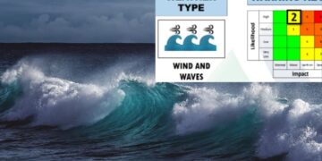
IMPACT-BASED WARNINGS
A. Yellow level 4 warning: Wind leading to difficulty in navigation at sea is expected between Table Bay and Plettenberg Bay, persisting until Wednesday.
B. Yellow level 2 warning: Waves resulting in localised disruption of small harbours and ports for a short period are expected between Alexander Bay and Plettenberg Bay, persisting until Wednesday.
C. Yellow level 1 warning: Wind leading to difficult driving conditions for small motor vehicles and blowing around of loose debris is expected over the south-east of Northern Cape.
FIRE DANGER WARNINGS:
A. Extremely high fire danger conditions are expected over north-eastern parts of Northern Cape, North-West Province, north-eastern parts of Free State, the central and northern parts OF Eastern Cape, western parts of KwaZulu-Natal,High- veld of Mpumalanga as well as the south-western Bushveld of Limpopo.
ADVISORIES:
NIL
ALSO READ: Weather forecast live updates
Conditions and UVB forecast
Gauteng
Temperature: Fine and warm.
The expected UVB Sunburn Index: Very High.
Mpumalanga
Temperature: Fine and warm, but hot in the Lowveld.
Limpopo
Temperature: Morning fog over the Lowveld, otherwise fine and warm to hot, but very hot in the extreme northern parts.
North West
Temperature: Fine and warm to hot.
Free State
Temperature: Fine and cool to warm. It will be windy in the extreme south.
Northern Cape
Temperature: Fine and cool to warm, but partly cloudy and cold in the west with morning fog along the coast and adjacent interior. It will be windy in the south.
Wind: The wind along the coast will be light to moderate northerly to north-westerly.
Western Cape
Temperature: Fine and cool in the east, otherwise partly cloudy and cold with isolated to scattered showers and rain in the south-west where it will be cloudy, but widespread over the extreme south-west. It will be windy in places.
Wind: The wind along the coast will be fresh to strong north-westerly to westerly, reaching gale force between Yzerfontein and Still Bay. It will become fresh to strong south-westerly towards the end of the period
The expected UVB Sunburn Index: Low.
Eastern Cape
The Western half: Morning fog in the north, otherwise fine and cool.
The Western half – The wind along the coast will be light north-westerly, becoming light and variable from late morning.
The Eastern half: Partly cloudy along the coast and adjacent interior at first, otherwise fine and cool to warm.
The Eastern half – Wind: The wind along the coast will be moderate to fresh northerly to north-easterly.
KwaZulu-Natal
Temperature: Fine and warm.
Wind: The wind along the coast will be moderate south-westerly to southerly, becoming north-easterly from the south in the afternoon, spreading northwards later.
The expected UVB Sunburn Index: High.
Stay up to date by viewing our daily Regional weather forecast here.
Weather forecast data provided by the South African Weather Service. For a detailed forecast of your province, click here.


