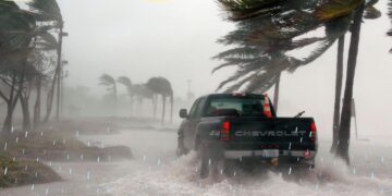
Weather warnings for severe thunderstorms, hail and winds were issued for many parts of SA on Monday afternoon. Read more here…
By: Corné van Zyl
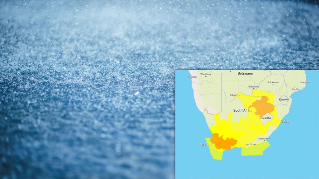
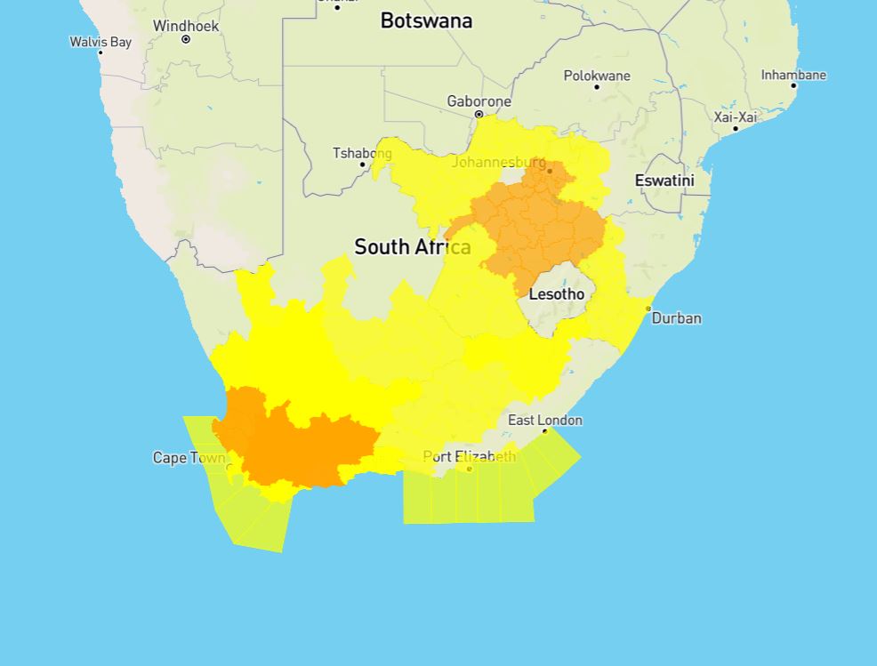
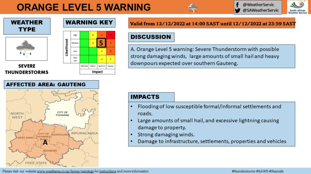
The SA Weather Services (SAWS) issued a level 5 warning for SEVERE THUNDERSTORMS with HAIL for parts of the Western Cape, Gauteng, Free State, and North West for Monday afternoon.
THE LEVEL 5 SEVERE THUNDERSTORMS AND HAILS ARE EXPECTED TO START NOW
Weather warnings were issued for most of South Africa on Monday afternoon.
The SAWS warned that damage to infrastructure, settlements, property, vehicles, communication disruption and loss of agricultural production is possible.
ALSO READ: Black Southeaster: Rare wind phenomenon expected in the Cape Peninsula
THESE AREAS WILL BE AFFECTED BY THE LEVEL 5 WARNING:
- Mogale City / Mogale City/Krugersdorp
- Ekurhuleni / Kempton park
- Rand West City – Randfontein / Randfontein
- Midvaal / Meyerton
- Merafong City / Merafong/Carletonville
- Lesedi / Lesedi/Heidelberg
- Ventersdorp/Tlokwe – Potch / Potchefstroom
- Emfuleni / Vereeniging
- Ngwathe / Ngwathe/Parys
- Mafube / Mafube/Frankfort
- Phumelela / Warden
- Nketoana / Reitz
- Dihlabeng / Bohlokong
- Moqhaka / Moqhaka/Kroonstad
- Maquassi Hills / Wolmaranstad
- Lekwa-Teemane / Bloemhof
- Nala / Khotsong/Bothaville
- Matjhabeng / Welkom
- Mantsopa / Ladybrand
- Cederberg / Clanwilliam
- Swartland / Malmesbury
- Witzenberg / Ceres
- Drakenstein / Paarl
- Breede Valley / Worcester
- Swellendam
- Kannaland / Ladismith
- Prince Albert
- Hessequa / Riversdale
- Theewaterskloof / Grabouw
- City of Cape Town / Cape Town city
The level 5 weather warning is expected from midday until midnight on Monday. It furthermore advised the public to stay indoors and away from metal objects if possible.
“Do not seek shelter under trees or tall objects. Stay away from fishing or playing golf, as both golf clubs and fishing rods are good conductors of electricity. Be aware that any combination of hail, strong winds and/or heavy downpours can accompany the storms. Keep an eye on the SAWS website for any updates regarding severe thunderstorm development and movement.”SAWS
THESE AREAS WILL BE AFFECTED BY THE LEVEL 3 WARNING:
Meanwhile, a level 3 warning for severe thunderstorms and hail was issued for these parts of the Northern Cape and Western Cape:
- Matzikama / Vredendal
- Karoo Hoogland / Sutherland
- Beaufort West
- George
- Mossel Bay / Mosselbay
- Bitou / Plettenberg Bay
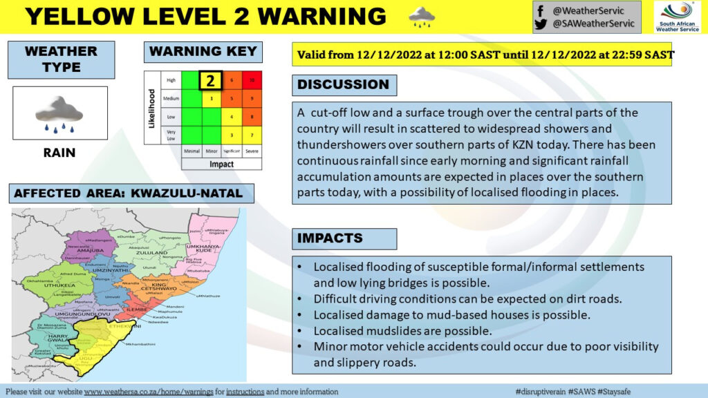
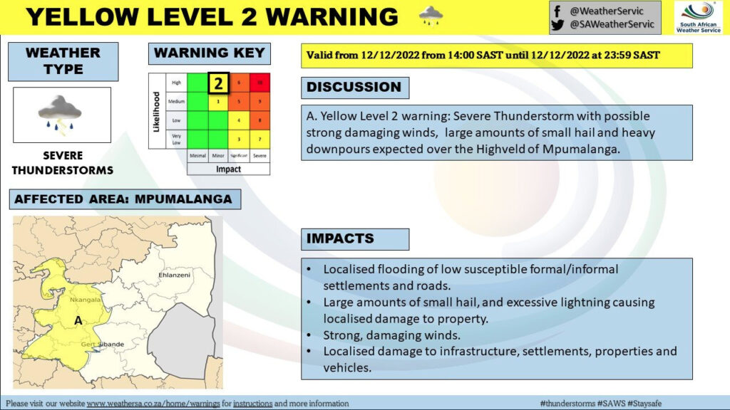
THESE AREAS WILL BE AFFECTED BY THE LEVEL 2 WARNING:
Meanwhile, a level 2 warning for damaging winds was also issued for today in these parts of the Western Cape, KwaZulu-Natal, Eastern Cape, and Mpumulanga:
- City of Tshwane / Pretoria
- Kgetlengrivier / Koster
- Steve Tshwete / Middelburg
- Emalahleni / Emalahleni/Witbank
- Ramotshere Moiloa / Zeerust
- Moses Kotane / Pilanesberg
- Mahikeng / Mafikeng
- Kagisano/Molopo / Tosca
- Tswaing / Ottosdal
- Mamusa / Schweizer-Reneke
- Kopanong / Fauresmith
- Letsemeng / Koffiefontein
- Thembelihle / Hopetown
- Walter Sisulu – Jamestown /
- Senqu / Barkly East
- Emthanjeni / De Aar
- Thembelihle / Hopetown
- Kareeberg / VanWyksvlei
- Hantam / Calvinia
- !Kheis / Groblershoop
- Khâi-Ma / Pofadder
- Enoch Magijima – Molteno / Molteno
- Walter Sisulu – Burgersdorp / Burgersdorp
- Mohokare / Aliwal North
- Ethekwini / King Shaka Airport
- Umzimkhulu
- Greater Kokstad / Kokstad
- Ubuhlebezwe / Ixopo
- Mkhambathini / Camperdown
- Impendle
- Okhahlamba / Royal National Park
- Blue Crane Route / Somerset East
- Dr Beyers Naude – Baviaans / Willowmore
- Raymond Mhlaba – Adelaide / Adelaide
- Kou-Kamma / Joubertina
Yes and lastly, a level 2 warning for damaging winds was also issued for these parts of the Western and Eastern Cape on Monday.
THESE AREAS WILL BE AFFECTED BY THE LEVEL 2 WARNING FOR DAMAGING WINDS:
- M_Buffalo City / Buffalo City
- M_Ndlambe / Port Alfred
- M_Sundays river valley / Cape Padrone
- M_Nelson Mandela Bay / Cape Recife
- M_Kou-Kamma / Tsitsikama
- M_Saldanha Bay / Saldanha Bay
- M_City of Cape town / Cape Point
- M_Overstrand / Hermanus
- M_Cape Agulhas / Cape
“These winds are expected to persist for most of the day from tomorrow late morning and likely result in difficult driving conditions due to fallen trees, difficulty in navigation for vessels at sea as well as some disruptions to harbours and/or ports. Localised problems for high-sided vehicles on prone routes e.g. due to cross winds on exposed high level roads/bridge. These winds are expected to enhance the risk of runaway fires.”SAWS\
It furthermore advised that the public should stay indoors where possible and away from the windows that open towards the severe winds.
“Be aware of the following: – sudden cross winds if traveling, especially between buildings, fallen trees or power lines, and flying debris. Small boats must stay away from the open sea and seek shelter in a harbour, river estuary or protected bay. Ensure that all temporary structures are well anchored.”
SAWS

