Weather forecast data provided by the South African Weather Service. For a detailed forecast of your province, click here.
Severe Weather Alerts
IMPACT-BASED WARNINGS:
A.Yellow Level 2 Warning for Disruptive Rain leading to localised flooding of susceptible formal/informal settlements and roads, low-lying areas and bridges, major roads affected but can be used, increased travel times, difficult driving conditions on dirt roads is expected over the City of Cape Town, western parts of Overberg as well as the southern parts of Cape Winelands.
B. Yellow Level 2 Warning for Damaging Wind resulting in localised problems for high-sided vehicles on prone routes are expected over the central and northern parts of the Western Cape and southern Namakwa of the Northern Cape.
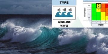
C. Yellow Level 2 Warning for Wind and Waves resulting in very rough and choppy seas as well as difficulty in navigation at sea are expected between Saldanha Bay and Plettenberg Bay, spreading eastwards reaching Port St. Johns but Yellow Level 4 is expected between Betty`s and Cape Agulhas.
D. Yellow Level 1 Warning for Winds of at least 60 km/h with a gust of 85 km/h, resulting localised damage to infrastructure are expected over the north-western and northern central parts of the Eastern Cape.
FIRE DANGER WARNINGS:
nil
ADVISORIES:
nil
Temperature and UVB forecast
Gauteng:
Temperature: Partly cloudy and warm, with isolated showers and thundershowers.
The expected UVB Sunburn Index: High.
Mpumalanga:
Temperature: Partly cloudy and warm with isolated showers and thundershowers.
Limpopo:
Temperature: Partly cloudy and warm with scattered showers and thundershowers but isolated in the south-east.
North-West Province:
Temperature: Partly cloudy and warm with isolated afternoon showers and thundershowers.
Free State:
Temperature: Partly cloudy and warm with isolated afternoon showers and thundershowers, except in the south-west.
Northern Cape:
Temperature: Cloudy and cool with morning fog along the coast, where isolated showers and rain are expected, otherwise fine and warm to hot but partly cloudy with isolated afternoon showers and thundershowers in the north-east.
Wind: The wind along the coast will be light to moderate westerly to north-westerly.
Western Cape:
Temperature: Cloudy to partly cloudy and cool to warm with light drizzle in the west at first. Isolated to scattered showers and rain are expected from the afternoon but widespread in the extreme south-western parts, clearing in the west by the evening.
Wind: The wind along the coast will be strong to gale westerly to north-westerly, reaching strong gale between Betty`s Bay and Cape Agulhas in the early morning, becoming southwesterly in the west from the afternoon.
The expected UVB Sunburn Index: Very High.
Eastern Cape:
The Western half – Cloudy in places in the south at first, otherwise partly cloudy and warm to hot, becoming cloudy in the south-west late afternoon, with isolated showers and rain spreading eastwards in the evening, but scattered along the coast.
The Western half -Wind: The wind along the coast will be moderate to fresh westerly, becoming strong southwesterly in the afternoon, reaching gale force in places.
The Eastern half -Hot in places in the east, otherwise fine and warm, becoming partly cloudy in the afternoon with isolated thundershowers. It will become cloudy in the south-west with rain and showers during the night.
The Eastern half – Wind: The wind along the coast will be light to moderate northerly along the Wild coast at first, otherwise moderate to fresh south-westerly, becoming strong overnight.
Kwazulu-Natal:
Temperature: Morning fog over the western interior, otherwise partly cloudy and warm to hot but very hot in places in the east. Isolated showers and thundershowers are expected.
Wind: The wind along the coast will be moderate to fresh north-easterly becoming southwesterly from the south by late afternoon
The expected UVB Sunburn Index: High.
Stay up to date by viewing our daily Regional weather forecast here.


